


Virtual History Tour of Marple on the move!
The Marple Website's collection of photos, known as the Virtual History Tour, began 24 years ago, in 2001. In 2006 it was moved to a Gallery platform called Coppermine. With the help of Marple Local History Society and others the "Tour" grew to hold over 15,500 images that have been viewed more than 6.7 Million times. In December 2024 migration to Piwigo, a more mobile friendly platform, began.

Migrating so many images will be a long process. While ongoing visitors will need to switch between 2nd Generation and 3rd Generation sites to access all the images available.
Migration progress is noted below in reverse cronological order...
24 August 2025
The High Lane album was migrated
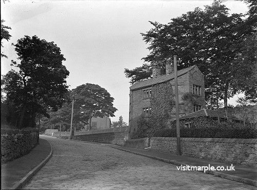
In the 1800s High Lane had large collieries employing the majority of men in the village and with the coming of the Macclesfield Canal in 1831 it formed a key junction with the main road to Buxton. Windlehurst Mill was built on the bank of the canal in 1872 and later came to an unusual end when it was so badly damaged in gales that it had to be demolished. This album features many shots of Buxton Road as well as Windlehurst Lane, Middlewood Road, Carr Brow, Norbury Hollow and St. Thomas's Church.

17 August 2025
The Compstall album was migrated
Compstall was formerly a mill village, built by George Andrew in the 1820s to house his 800 workers. Most of the original mill cottages and other structures remain unchanged. The waterways that now form Etherow Park were also constructed by Andrew to carry water from the weir on the river to turn the mill wheel, which stood where the car park is today.
Some of the images in this album are technically Marple Bridge but seem to sit better here.

11 August 2025
The Strines album was migrated
The Strines area is a beautiful part of the world steeped in history and set in the picturesque Goyt River Valley. There are some very old properties in and around Strines dating back many hundreds of years, however the majority of properties were built after the Printworks was established circa 1790.

3 August 2025
The Hawk Green and Goyt Mill albums are migrated
Hawk Green is an outlying area of Marple, centred around a traditional village green, or recreation ground. There are earlier buildings but most of the housing built up around the Shepley Mill, constructed in 1848 on the side of the Macclesfield Canal. There is a sub-album covering the Goyt Mill, constructed in 1905, which remains a major landmark in the area today.

The Goyt Mill sub-album contains pictures of the mill built in 1905 at Hawk Green. It features the demolition of the huge chimney, a visible landmark for miles around, and the machinery in the mill before it was removed.

28 July 2025
The Marple Buildings and Street Scenes album is fully migrated
The Marple album in the Buildings and Street Scenes category contains 2,084 images in 19 separate sub-albums that were migrated between 18 December 2024 and 25 July 2025. Next up: Mellor, Marple Bridge, Hawk Green, Strines and High Lane.

25 July 2025
The Albert Schools / E&E Overalls album was migrated.
E & E Overalls / E & E Workwear used the former Albert Schools building since the late 1960 / early 1970s. In 2018 planning permission was granted to demolish the old buildings and replace them with new apartments and retail premises. The photos in this album were taken in February / March 2019, during the week before final closure.

21 July 2025
The Stockport Hydro album was migrated.
The Stockport hydro scheme at Otterspool Weir is Manchester's first community-owned hydro-electric project. This album contains photos taken by local people during its construction and since it began generating electricity in October 2012.
Thank you to Arthur Procter, Bill Beard, Ray Noble and Axel Thomas for sharing your photos.

20 July 2025
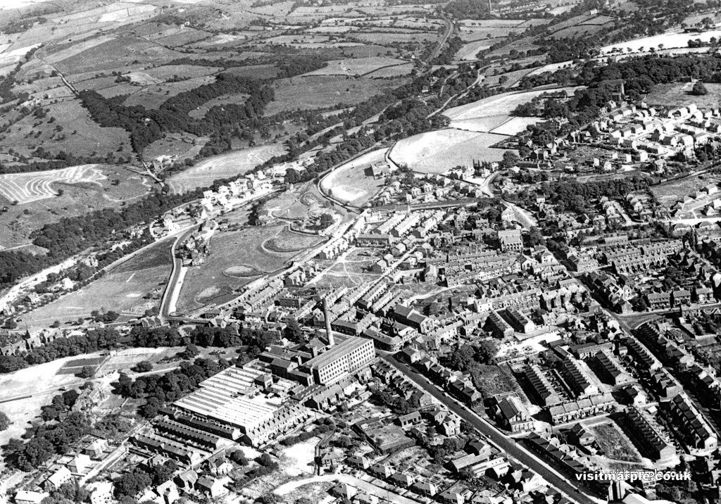
The Marple from the Air album was migrated.
The aerial images on the Virtual Tour were taken between 1955 and the early 1960s. They can be dated by the Hollins Mill, still there in 1955 but demolished in 1957, and Hollins Parade and Hanburys being built in the late 50s or early 60s. The photos are from Marple Local History Society's Archives. There are also four fascinating aerial images of Marple in the Aerofilms Collection on the Historic England web site that were taken in October 1929. These can't be included on the Virtual Tour but they are embedded in this special page.
19 July 2025
The Lime Kilns album was migrated.
Little of Samuel Oldknow's Lime Kilns remain today and it is difficult to imagine the scale and impact that these early industrial buildings had on Marple's landscape. The images in this album will help to give some idea. Click here to read more about the Lime Kilns.

16 July 2025
The Miscellaneous Marple album was migrated.
This album contains all those pictures of the Marple area where we didn't have quite enough to create separate albums when the tour began. Areas such as Hibbert Lane, Chadwick Street, Stone Row, Cross Lane and Hollins Mill, to name just a few. Over time it's grown to a large album of more than 500 images and once everything is migrated there will be some sorting out to do!
8 February 2025
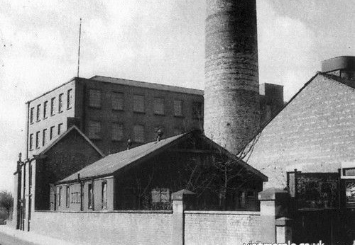
The Park & Paterson Foundry album was migrated.
Park and Paterson (Manchester) Ltd was situated on Cross Lane, Marple. The original foundry premises were built during the latter part of the 19th century and had railway access from the adjoining Rose Hill line. The firm went into receivership in 2004. The photos in this album are from Marple Local History Society Archives and include some of Park and Paterson's Parkhead Glasgow Works for completeness. Unfortunately most of the images are undated.

6 February 2025
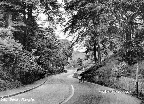
The Dan Bank and Dooley Lane album was migrated.
This album covers the Dan Bank and Dooley Lane area, including Otterspool, Chadkirk and as far up as Bunker's Hill. You could claim that some of this is not strictly Marple but then you'd be missing out on some great local photographs of the most familiar routes into and out of the town.
31 January 2025
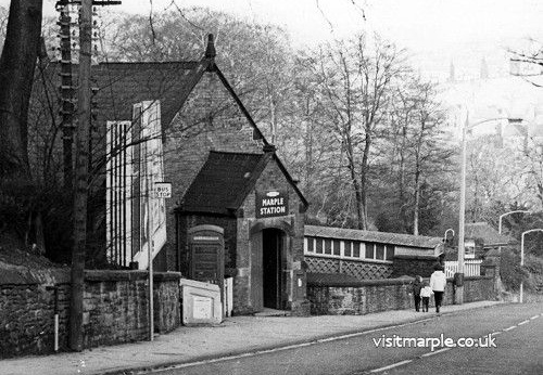
The Railways album was migrated.
This album contains everything we have relating to railways in Marple. There are separate sub-albums for Marple Station, Marple Station Improvements and Rose Hill Station with everything else, including both Middlewood Stations and Ludworth Moor Tramway, residing in the higher-level Railways album. If you have any Marple Railways related images we don't, please consider sharing them.
19 January 2025
The Station Road and Brabyns Brow album was migrated.
This album covers Station Road from the junction with Stockport Road up past Memorial Park towards Marple Station, where it turns into Brabyns Brow, and on down the Brow past Brabyns Park and on to Marple Bridge. It also features the frequent crashes on Brabyns Brow before the road and Marple Bridge were widened and straightened in the 1930s.
These are just a small selection of the images in the album.
18 January 2025
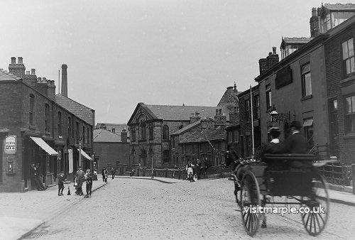
The Church Lane album was migrated.
This album covers Church Lane, running from the junction with Stockport Road up, past the Hatters Arms and the junctions with Hibbert Lane and Market Street, on past the Con Club and the Ring o' Bells and all the way to All Saints' Church.
7 January 2025
The Hollins Mill Estate album was migrated.
The Hollins estate was first mentioned in 1712 and when Hollins Mill was built in 1830 the present day centre of Marple developed around it. Nothing is left of the Mill today but Marple Memorial Park remains at the heart of Marple and is a lasting legacy of the mill owners' generosity and the community's losses during the Great War. This album contains images relating to the mill and the estate, including Marple Memorial Park.
7 January 2025
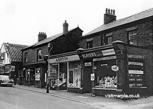
The Market Street and Derby Way album was migrated.
Market Street is now the thriving centre of Marple shopping, paved over in the 1970s and regenerated several times. The older pictures in this album show a very different Market Street, before pedestrianisation, but it's clear that it was at the heart of the community then too.
19 December 2024
The Marple District Centre album, dating back 54 years, was migrated.
Marple District Centre was changed radically in the 1970s when Market Street was paved over and Hibbert Lane was extended between Church Lane and Stockport Road. The numbered images in this album were taken by Marple UDC during these changes and the location of each shot was marked on a large plan of the area, which is also included as the first image in the album. Additional photos taken by Pete Robinson during the mid-1970s to early 1980s were provided by Eddie Ashworth in 2015. Both Eddie and Pete worked on the District Centre improvements for several years back in the day.
18 December 2024
The following sub-albums were migrated:
These three sub-albums are part of the Marple Album in the Building and Street Scenes Category.
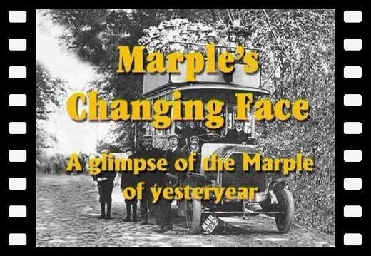
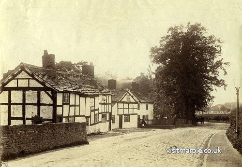
Marple's Changing Face
Marple's Changing Face presentation by Gordon Mills: An imaginary journey through the Marple of yesteryear using old photographs (some over 120 years old), together with some more recent photographs (April 2003) for comparison.
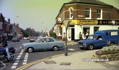
Stockport Road West
This album of Stockport Road covers the section from Dan Bank to the junctions of Station Road and Church Lane, where for so many years the Jolly Sailor Pub was a major landmark at the heart of the community.
Stockport Road East
This second album of Stockport Road covers the area beyond the junctions with Station Road and Church Lane up to the Navigation Hotel, another major landmark central to the community that thankfully remains.
6 December 2024:
3rd Generation site launched!
The following albums were migrated before making the new site "live" on 6th December 2024:
